Elements area
Identifier
F223-S3-f1-CO3N
Title
"Coquitlam and Silver Peaks" (map and expedition account)
Creator
Neal Carter (1902-1978)
Creator
Date(s)
-
1911
Description
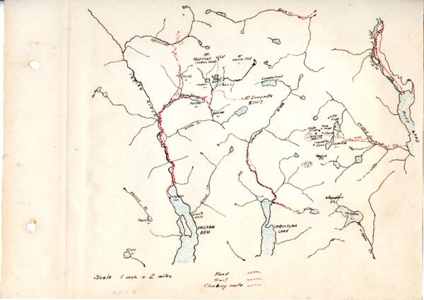
When European settlers first explored the North Shore Mountains, they had no maps. Creating their own surveys and making their own maps formed part of their expeditions.
This beautiful hand-drawn map of the backcountry area north of Indian Arm and Coquitlam Lake was made by Neal Carter and is one of the first paper maps of the area — or perhaps even the very first. The map is part of a photo album he made showing peaks of the area. Attached to the map is a 2 page account by Nellie Fraser of expeditions of Coquitlam Mtn. by ACC members.
Subjects
Types
- text
Format
Source
Fonds 223 - Alpine Club of Canada - Vancouver Section - Box 15